Commons:Wiki Loves Monuments 2016 in Malaysia

Wiki Loves Monuments (http://www.wikilovesmonuments.org) is an annual international photography contest and crowdsourcing event in which participants photograph and upload images of historic monuments to Wikimedia Commons. These images are then available for free use on Wikipedia and beyond. More details about this year's annual competition can be found at Wiki Loves Monuments 2016. The competition takes place throughout the month of September each year.
This will be the First time Malaysia has taken part in the competition, and everyone is welcome to get involved, whether as a participant (photographer), organisational volunteer, or both. There is no requirement for participants or volunteers to be from Malaysia .
The Malaysia part of the competition is volunteer-led, with significant support from our team WIKI Loves Monuments Malaysia 2016.
Let's CAPTURE THE MOMENTS OF MONUMENTS IN MALAYSIA and share them with the rest of the world!
User:Ammarah Khalid is the point of contact for WLM Malaysia 2016
https://www.facebook.com/WLMMalaysia/
About the contest
[edit]Wiki Loves Monuments in the Malaysia will follow the same rules as the international competition. Participants upload pictures taken by themselves of listed buildings within Malaysia and upload them to Wikimedia Commons during the month of September under a free licence. Uploaded photographs do not have to be taken during September 2016, but they must not have been uploaded to Wikimedia Commons before. Participants are free to take photographs of any eligible building, even if Commons already has one or more photographs, but of course a new angle or a new detail is more useful to the project than simply repeating what has been done before.
Rules for participation
[edit]Wiki Loves Monuments contest has only few rules to for the photos to participate in the WLM Malaysia Contest.
Click Rules to see the rules and how to participate.
Let's CAPTURE THE MOMENTS OF MONUMENTS IN MALAYSIA share them with the rest of the world!
Map of Malaysia
[edit]
List of cultural heritage monuments and historical buildings in Malaysia by State
[edit]State of Johor
[edit]| SITE-ID | BUILDING NAME | BUILDING TYPE | LOCATION | COORDINATES | PHOTO | UPLOAD |
|---|---|---|---|---|---|---|
| 01-JHR/1 | Bukit Zaharah Palace | Palace/ Royal | Johor Bahru | 
| ||
| 01-JHR/2 | Central Police Headquarters | Government | Johor Bahru | 1°28′37″N 103°45′51″E / 1.477076°N 103.764199°E |  |

|
| 01-JHR/3 | Church of Immaculate Conception | Church | Johor Bahru | 1°27′54″N 103°45′32″E / 1.465125°N 103.758895°E |  |

|
| 01-JHR/4 | Johor Bahru High Court | Government | Johor Bahru | 1°27′21″N 103°45′36″E / 1.455860°N 103.760037°E |  |

|
| 01-JHR/5 | Dato Jaafar Residence | Residence | Johor Bahru | 1°28′20″N 103°45′56″E / 1.472336°N 103.765598°E |  |

|
| 01-JHR/6 | Flower Garden Building | Government | Johor Bahru | 
| ||
| 01-JHR/7 | General Hospital | Public facility | Johor Bahru | 
| ||
| 01-JHR/8 | Hilltop Private School | Academic Institution | Johor Bahru | 1°27′59″N 103°45′16″E / 1.466408°N 103.754581°E |  |

|
| 01-JHR/9 | Johor Art Gallery (Dato' Abdullah Jaafar Residence) | Residence | Johor Bahru | 1°28′00″N 103°44′51″E / 1.466612°N 103.747462°E |  |

|
| 01-JHR/10 | Maktab Sultan Abu Bakar (English College) | Academic Institution | Johor Bahru | 1°27′48″N 103°44′22″E / 1.463391°N 103.739319°E |  |

|
| 01-JHR/11 | Markas Timbalan Setia Negeri | Fort/Military | Johor Bahru | 
| ||
| 01-JHR/12 | Pasir Pelangi Royal Mosque | Mosque | Johor Bahru | 1°29′18″N 103°47′08″E / 1.488250°N 103.785681°E |  |

|
| 01-JHR/13 | Pasir Pelangi Palace | Palace/ Royal | Johor Bahru | 
| ||
| 01-JHR/14 | Johor Bahru Railway Station | Railway Station | Johor Bahru | 1°27′40″N 103°45′55″E / 1.461111°N 103.765304°E |  |

|
| 01-JHR/15 | Roman Catholic Church | Church | Johor Bahru | 
| ||
| 01-JHR/16 | Royal Johor Club | Social Institution | Johor Bahru | 
| ||
| 01-JHR/17 | Royal Mausoleum | Mausoleum | Johor Bahru | 1°27′55″N 103°45′03″E / 1.465206°N 103.750795°E |  |

|
| 01-JHR/18 | Royal Museum (Sultan Abu Bakar Palace) | Palace/ Royal | Johor Bahru | 1°27′18″N 103°45′23″E / 1.455022°N 103.756438°E |  |

|
| 01-JHR/19 | Sultan Abu Bakar State Mosque | Mosque | Johor Bahru | 1°27′25″N 103°45′04″E / 1.456886°N 103.751198°E |  |

|
| 01-JHR/20 | Sultanah Aminah Hospital | Public facility | Johor Bahru | 1°27′31″N 103°44′46″E / 1.458744°N 103.746118°E |  |

|
| 01-JHR/21 | Sultan Ibrahim Building | Governement | Johor Bahru | 1°27′28″N 103°45′40″E / 1.457832°N 103.761095°E |  |

|
| 01-JHR/22 | Muar Clock Tower | Monument | Muar | 2°02′56″N 102°34′08″E / 2.048766°N 102.568923°E |  |

|
| 01-JHR/23 | Gurdwara Sahib | Gurdwara | Johor Bahru | 1°27′35″N 103°45′49″E / 1.459826°N 103.763735°E |  |

|
| 01-JHR/24 | Broadway Theatre | Cinema | Johor Bahru |  |

| |
| 01-JHR/25 | Johor Bahru Old Chinese Temple | Temple | Johor Bahru | 1°27′39″N 103°45′47″E / 1.460728°N 103.763087°E |  |

|
| 01-JHR/26 | Istana Bukit Serene | Palace/ Royal | Johor Bahru | 1°28′46″N 103°43′35″E / 1.479521°N 103.726290°E |  |

|
| 01-JHR/27 | Dataran Bandaraya Johor Bahru | Monuments | Johor Bahru | 1°27′37″N 103°44′29″E / 1.460200°N 103.741358°E |  |

|
| 01-JHR/28 | Istana Besar | Official Residence | Johor Bahru | 1°27′18″N 103°45′23″E / 1.454992°N 103.756458°E |  |

|
| 01-JHR/29 | Gatepost of Sultan Abu Bakar Mosque | Monument | Johor Bahru | 1°27′29″N 103°45′07″E / 1.458189°N 103.751983°E |  |

|
| 01-JHR/30 | Sultan Ibrahim Jamek Mosque | Mosque | Muar | 2°02′47″N 102°33′30″E / 2.046434°N 102.558444°E |  |

|
| 01-JHR/31 | Muar High School | Academic Institution | Muar | 2°02′41″N 102°33′41″E / 2.044648°N 102.561504°E |  |

|
| 01-JHR/32 | Arulmigu Rajamariamman Devasthanam Temple | Temple | Johor Bahru | 1°27′33″N 103°45′50″E / 1.459246°N 103.764003°E |  |

|
State of Malacca
[edit]| SITE-ID | BUILDING NAME | BUILDING TYPE | LOCATION | COORDINATES | PHOTO | UPLOAD |
|---|---|---|---|---|---|---|
| 04-MLK/1 | Malacca High School | Educational Institution | Malacca City | 2°11′31″N 102°15′16″E / 2.192061°N 102.254563°E |  |

|
| 04-MLK/2 | Malacca Straits Mosque | Mosque | Malacca Island | 2°10′44″N 102°14′57″E / 2.178959°N 102.249038°E |  |

|
| 04-MLK/3 | Malacca Sultanate Palace Museum | Old Palace | Malacca City | 2°11′34″N 102°15′02″E / 2.192878°N 102.250439°E |  |

|
| 04-MLK/4 | St. Francis Institution | Educational Institution | Malacca City | 2°11′30″N 102°15′11″E / 2.191620°N 102.253147°E |  |

|
| 04-MLK/5 | Kampung Kling Mosque | Mosque | Malacca City | 2°11′48″N 102°14′51″E / 2.196804°N 102.247504°E |  |

|
| 04-MLK/6 | St Xavier’s Church | Church | Malacca City | 2°11′43″N 102°15′02″E / 2.195198°N 102.250663°E |  |

|
| 04-MLK/7 | Clock Tower | Monument | Dutch Square | 2°11′40″N 102°14′57″E / 2.194398°N 102.249079°E |  |

|
| 04-MLK/8 | Queen Victoria's Fountain | Monument | Dutch Square | 2°11′40″N 102°14′57″E / 2.194424°N 102.249159°E |  |

|
| 04-MLK/9 | Independence Memorial Building | Government | Malacca City | 2°11′31″N 102°15′03″E / 2.191917°N 102.250901°E |  |

|
| 04-MLK/10 | Sekolah Kebangsaan Bandar Hilir | Educational Institution | Malacca City | 2°11′30″N 102°15′09″E / 2.191644°N 102.252367°E |  |

|
| 04-MLK/11 | Christ Church | Church | Malacca City | 2°11′40″N 102°14′58″E / 2.194329°N 102.249480°E |  |

|
| 04-MLK/12 | A Famosa | Fort Remains | Malacca City | 2°11′31″N 102°15′01″E / 2.191869°N 102.250266°E |  |

|
| 04-MLK/13 | St Paul's Church (Ruins) | Church Ruins | Malacca City | 2°11′33″N 102°14′59″E / 2.192621°N 102.249609°E |  |

|
| 04-MLK/14 | St. Peter's Church | Church | Malacca City | 2°11′33″N 102°14′59″E / 2.192610°N 102.249598°E |  |

|
| 04-MLK/15 | Tamil Methodist Church | Church | Malacca City | 2°11′54″N 102°14′41″E / 2.198415°N 102.244696°E |  |

|
| 04-MLK/16 | Al-Azim Mosque | Mosque | Malacca City | 2°12′55″N 102°15′45″E / 2.215390°N 102.262389°E |  |

|
| 04-MLK/17 | Kampung Hulu Mosque | Mosque | Malacca City | 2°11′57″N 102°14′51″E / 2.199292°N 102.247576°E |  |

|
| 04-MLK/18 | Malacca Chinese Mosque | Mosque | Krubong | 2°17′45″N 102°13′49″E / 2.295937°N 102.230244°E |  |

|
| 04-MLK/19 | Tranquerah Mosque | Mosque | Malacca City | 2°12′15″N 102°13′55″E / 2.204152°N 102.232016°E |  |

|
| 04-MLK/20 | St John's Fort | Fort | Malacca City | 2°11′22″N 102°15′53″E / 2.189332°N 102.264623°E |  |

|
| 04-MLK/21 | Malacca Stamp Museum | Museum | Malacca City | 2°11′30″N 102°14′58″E / 2.191630°N 102.249505°E |  |

|
| 04-MLK/22 | Malaysia Architecture Museum | Museum | Malacca City | 2°11′34″N 102°14′55″E / 2.192724°N 102.248573°E |  |

|
| 04-MLK/23 | Literature Museum | Museum | Malacca City | 2°11′38″N 102°14′58″E / 2.193806°N 102.249540°E |  |

|
| 04-MLK/24 | Southern Bank | Commercial | Malacca City | 2°11′58″N 102°15′10″E / 2.199396°N 102.252781°E |  |

|
| 04-MLK/25 | Peranakan Museum | Museum | 
| |||
| 04-MLK/26 | Police Headquarters | Government | Bukit Beruang | 2°15′31″N 102°16′49″E / 2.258518°N 102.280144°E |  |

|
| 04-MLK/27 | Stadhuys Building | Museum | Malacca City | 2°11′39″N 102°14′58″E / 2.194181°N 102.249503°E |  |

|
| 04-MLK/28 | Casa Cuba | Gallery | Bukit Peringgit | 2°13′20″N 102°15′26″E / 2.222250°N 102.257278°E |  |

|
| 04-MLK/29 | Macau Gallery Malacca | Gallery | Bukit Peringgit | 2°13′17″N 102°15′20″E / 2.221358°N 102.255543°E |  |

|
| 04-MLK/30 | Historical Malacca City Council | Government | Ayer Keroh | 2°13′59″N 102°16′49″E / 2.233097°N 102.280254°E |  |

|
| 04-MLK/31 | The Baba and Nyonya House Museum | Museum | Malacca City | 2°11′43″N 102°14′48″E / 2.195341°N 102.246712°E |  |

|
State of Penang
[edit]| SITE-ID | BUILDING NAME | BUILDING TYPE | LOCATION | COORDINATES | PHOTO | UPLOAD |
|---|---|---|---|---|---|---|
| 07-PNG/1 | Kapitan Kling Mosque | Mosque | George Town | 5°25′01″N 100°20′14″E / 5.416928°N 100.337138°E |  |

|
| 07-PNG/2 | Fort Cornwallis | Fort | George Town | 5°25′14″N 100°20′38″E / 5.420664°N 100.343941°E |  |

|
| 07-PNG/3 | St. George’s Church | Church | George Town | 5°25′11″N 100°20′21″E / 5.419705°N 100.339108°E |  |

|
| 07-PNG/4 | Penang Museum and Art Gallery | Museum | George Town | 5°25′18″N 100°20′26″E / 5.421752°N 100.340639°E |  |

|
| 07-PNG/5 | St. Xavier’s Institution | Educationl Institution | George Town | 
| ||
| 07-PNG/6 | Church of The Assumption | Church | George Town | 5°25′14″N 100°20′16″E / 5.420497°N 100.337694°E |  |

|
| 07-PNG/7 | State Assembly Building | Government | George Town | 5°25′09″N 100°20′36″E / 5.419299°N 100.343221°E |  |

|
| 07-PNG/8 | State Religious Council | Government | George Town | 
| ||
| 07-PNG/9 | Old Town Hall, Esplanade | George Town | 5°25′16″N 100°20′28″E / 5.421179°N 100.341143°E |  |

| |
| 07-PNG/10 | Eastern & Oriental Hotel | Hotel | George Town | 5°25′24″N 100°20′10″E / 5.423369°N 100.336010°E |  |

|
| 07-PNG/11 | Algemene Bank | George Town | 
| |||
| 07-PNG/12 | Seri Mutiara | Residential | George Town | 
| ||
| 07-PNG/13 | Kampar Lodge | George Town | 
| |||
| 07-PNG/14 | Victoria Tower | Monument | George Town | 5°25′09″N 100°20′39″E / 5.419239°N 100.344049°E |  |

|
| 07-PNG/15 | Fine Arts Conservatory (now INTEC College) | Educationl Institution | George Town | 
| ||
| 07-PNG/16 | Metropole Hotel | Hotel | George Town | 
| ||
| 07-PNG/17 | Immigration Departmen | Government | George Town | 
| ||
| 07-PNG/18 | Old City Hall, Esplanade | Monument | George Town | 
| ||
| 07-PNG/19 | High Court | Government | George Town | 5°25′14″N 100°20′23″E / 5.420693°N 100.339709°E |  |

|
| 07-PNG/20 | Penang Railway Building | Public | George Town | 
| ||
| 07-PNG/21 | Customs and Excise Dept | Government | George Town | 5°24′56″N 100°20′33″E / 5.415573°N 100.342514°E |  |

|
| 07-PNG/23 | Lim Mah Chye’s Mansion | Residential | George Town |  |

| |
| 07-PNG/24 | Yeoh Cheang Seng’s Residence | Residential | George Town |  |

| |
| 07-PNG/25 | Columbia Lodge | Residential | George Town | 
| ||
| 07-PNG/26 | Hill Railway Station | Public | George Town |  |

| |
| 07-PNG/27 | George Town Dispensary | George Town |  |

| ||
| 07-PNG/28 | Standard Chartered Bank | Bank | George Town | 5°25′07″N 100°20′36″E / 5.418686°N 100.343224°E |  |

|
| 07-PNG/29 | Lim Lean Teng’s Mansion (Woodville) | Residential | George Town | 5°25′24″N 100°20′03″E / 5.423299°N 100.334150°E | 
| |
| 07-PNG/30 | Leong Yin Kean’s Residence | Residential | George Town | 
| ||
| 07-PNG/31 | Hu Yew Seah Building | Government | George Town | 
| ||
| 07-PNG/32 | Chinese Chamber of Commerce | Government | George Town | 5°25′12″N 100°20′30″E / 5.420048°N 100.341797°E |  |

|
| 07-PNG/33 | Penang City Hall | Government | George Town | 5°25′19″N 100°20′29″E / 5.421975°N 100.341447°E |  |

|
| 07-PNG/34 | Sri Mahamariamman Temple | Temple | George Town | 5°25′02″N 100°20′18″E / 5.417212°N 100.338309°E |  |

|
| 07-PNG/35 | Kek Lok Si Temple | Temple | Air Itam | 5°23′59″N 100°16′25″E / 5.399584°N 100.273706°E |  |

|
| 07-PNG/36 | Cheong Fatt Tze Mansion | Residential | George Town | 5°25′18″N 100°20′05″E / 5.421552°N 100.334813°E | 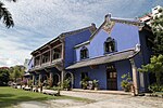 |

|
| 07-PNG/37 | Snake Temple | Temple | Bayan Lepas | 5°18′51″N 100°17′07″E / 5.314076°N 100.285249°E |  |

|
State of Selangor
[edit]| SITE-ID | BUILDING NAME | BUILDING TYPE | LOCATION | COORDINATES | PHOTO | UPLOAD |
|---|---|---|---|---|---|---|
| 10-SGR/1 | Istana Bandar | Royal Palace | Kuala Langat | 
| ||
| 10-SGR/2 | Wat Chetawan | Temple | Petaling Jaya | 3°06′10″N 101°39′05″E / 3.102669°N 101.651306°E |  |

|
| 10-SGR/3 | Darul Ehsan Arch | Monument | Petaling Jaya | 3°06′44″N 101°39′24″E / 3.112273°N 101.656578°E |  |

|
| 10-SGR/4 | Sultan Alam Shah Museum | Museum | Shah Alam | 3°04′32″N 101°31′17″E / 3.075477°N 101.521334°E |  |

|
| 10-SGR/5 | Orang Asli Museum | Museum | Gombak | 3°17′42″N 101°43′56″E / 3.295051°N 101.732138°E |  |

|
| 10-SGR/6 | Palace of Justice | Government | Putrajaya | 2°55′02″N 101°41′10″E / 2.917186°N 101.686111°E |  |

|
| 10-SGR/7 | Alaeddin Mosque | Mosque | Kuala Langat | 2°51′48″N 101°26′23″E / 2.863290°N 101.439792°E |  |

|
| 10-SGR/8 | Old Prison/ Police Station | Goverment | 
| |||
| 10-SGR/9 | Royal Mausoleum of Sultan Abdul Samad | Memorial building | Kuala Langat | 
| ||
| 10-SGR/10 | Bukit Malawati Historical Complex | Kuala Selangor | 3°20′30″N 101°14′47″E / 3.341569°N 101.246393°E |  |

| |
| 10-SGR/11 | Sultan Salahuddin Abdul Aziz Mosque | Mosque | Shah Alam | 3°04′43″N 101°31′15″E / 3.078665°N 101.520804°E | 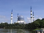 |

|
| 10-SGR/12 | The palace of the Sultan of Selangor | Royal Palace | Klang | 3°02′09″N 101°26′56″E / 3.035740°N 101.448776°E |  |

|
| 10-SGR/13 | Klang Municipal Council | Government | Klang | 3°02′42″N 101°26′41″E / 3.044899°N 101.444705°E |  |

|
| 10-SGR/14 | Pasar Jawa Mosque | Mosque | Klang | 3°02′52″N 101°26′45″E / 3.047747°N 101.445713°E |  |

|
| 10-SGR/15 | Church of Our Lady of Lourdes | Church | Klang | 3°02′14″N 101°26′40″E / 3.037351°N 101.444307°E |  |

|
| 10-SGR/16 | Royal Gallery of Sultan Abdul Aziz | Museum | Klang | 3°02′29″N 101°26′57″E / 3.041297°N 101.449190°E |  |

|
| 10-SGR/17 | The Millennium Monument | Monument | Putrajaya | 2°55′25″N 101°40′58″E / 2.923506°N 101.682646°E |  |

|
| 10-SGR/18 | Cyberjaya Mosque | Mosque | Cyberjaya | 2°55′57″N 101°38′53″E / 2.932427°N 101.647973°E |  |

|
| 10-SGR/19 | Putra Mosque | Mosque | Putrajaya | 2°56′10″N 101°41′22″E / 2.935974°N 101.689385°E |  |

|
| 10-SGR/20 | Batu Caves | Temple | Gombak | 3°14′16″N 101°41′02″E / 3.237863°N 101.684017°E |  |

|
| 10-SGR/21 | Sri Mahamariamman Temple | Temple | Kuala Lumpur | 3°08′36″N 101°41′47″E / 3.143430°N 101.696476°E | 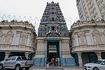 |

|
State of Sabah
[edit]| SITE-ID | BUILDING NAME | BUILDING TYPE | LOCATION | COORDINATES | PHOTO | UPLOAD |
|---|---|---|---|---|---|---|
| 12-SBH/1 | Old General Post Office | Government | Kota Kinabalu |  |

| |
| 12-SBH/2 | St. Michael's Church | Church | Sandakan |  |

| |
| 12-SBH/3 | Atkinson Clock Tower | Monument | Kota Kinabalu | 5°58′56″N 116°04′38″E / 5.982154°N 116.077315°E |  |

|
| 12-SBH/4 | Social Welfare Dept | Government | 
| |||
| 12-SBH/5 | Kota Kinabalu City Mosque | Mosque | Kota Kinabalu | 5°59′45″N 116°06′28″E / 5.995764°N 116.107768°E |  |

|
| 12-SBH/6 | Yayasan Sabah Tower | Kota Kinabalu | 6°01′03″N 116°06′35″E / 6.017393°N 116.109708°E |  |

| |
| 12-SBH/7 | Sabah Museum | Museum | Kota Kinabalu | 5°57′38″N 116°04′17″E / 5.960659°N 116.071444°E |  |

|
| 12-SBH/8 | War Memorial | Monument | Kundasang | 5°59′14″N 116°34′35″E / 5.987333°N 116.576435°E | 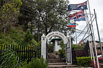 |

|
| 12-SBH/9 | Labuan Landmark | Monument | Labuan | 
| ||
| 12-SBH/10 | Sikh Temple | Temple | Kota Kinabalu | 5°57′24″N 116°03′56″E / 5.956740°N 116.065434°E |  |

|
| 12-SBH/11 | Chimney Labuan | Monument | Labuan | 5°22′50″N 115°14′57″E / 5.380505°N 115.249040°E |  |

|
| 12-SBH/12 | Hundred Steps | Sandakan | 
| |||
| 12-SBH/13 | Sandakan Jamek Mosque | Mosque | Sandakan |  |

| |
| 12-SBH/14 | Sam Sing Kung Temple | Temple | Sandakan |  |

| |
| 12-SBH/15 | Labuan Museum | Museum | Labuan | 5°16′37″N 115°14′43″E / 5.276937°N 115.245359°E |  |

|
| 12-SBH/16 | SMK St Michael | Educational Institution | Sandakan | 
| ||
| 12-SBH/17 | William Pryer Memorial | Monument | Sandakan |  |

| |
| 12-SBH/18 | Kwang Fook Kong Temple | Temple | Labuan |  |

| |
| 12-SBH/20 | Labuan Jamek Mosque | Mosque | Labuan | 5°17′01″N 115°14′52″E / 5.283571°N 115.247783°E |  |

|
State of Perak
[edit]| SITE-ID | BUILDING NAME | BUILDING TYPE | LOCATION | COORDINATES | PHOTO | UPLOAD |
|---|---|---|---|---|---|---|
| 08-PRK/1 | Ali Pitchay Town House | Residential | Ipoh | 
| ||
| 08-PRK/2 | Foong Seong Villa | Residential | Ipoh |  |

| |
| 08-PRK/3 | Anglo-Chinese School | Educational Institution | Ipoh | 4°35′29″N 101°04′21″E / 4.591287°N 101.072456°E |  |

|
| 08-PRK/4 | Central Police Station | Government | Ipoh | 4°35′43″N 101°04′29″E / 4.595360°N 101.074747°E |  |

|
| 08-PRK/5 | City Hall Building | Government | Ipoh | 4°35′50″N 101°04′30″E / 4.597164°N 101.075121°E |  |

|
| 08-PRK/6 | Clock Tower | Monument | Taiping |  |

| |
| 08-PRK/7 | Convent School Ipoh | Educational Institution | Ipoh |  |

| |
| 08-PRK/8 | Court House | Court | Batu Gajah | 4°28′31″N 101°02′12″E / 4.475265°N 101.036772°E |  |

|
| 08-PRK/9 | Dato' Panglima Kinta Mosque | Mosque | Ipoh |  |

| |
| 08-PRK/10 | Dato' Sri Adika Raja House | Residential | Ipoh | 
| ||
| 08-PRK/11 | Ipoh Railway Station | Puclic | Ipoh | 4°35′51″N 101°04′24″E / 4.597434°N 101.073451°E |  |

|
| 08-PRK/12 | Ipoh Royal Club | Ipoh |  |

| ||
| 08-PRK/13 | Istana Hulu | Gallery | Kuala Kangsar | 4°45′59″N 100°56′52″E / 4.766302°N 100.947640°E |  |

|
| 08-PRK/14 | J.W.W. Birch Clock Tower | Monument | Ipoh | 4°35′49″N 101°04′34″E / 4.596839°N 101.076141°E |  |

|
| 08-PRK/15 | Jamek Mosque | Mosque | Ipoh | 4°35′46″N 101°04′33″E / 4.596170°N 101.075805°E |  |

|
| 08-PRK/16 | Batu Gajah Hospital | Hospital | Batu Gajah | 4°28′47″N 101°02′04″E / 4.479701°N 101.034401°E |  |

|
| 08-PRK/17 | Indian Mosque | Mosque | Ipoh | 
| ||
| 08-PRK/18 | Guan Yin Temple | Temple | Ipoh |  |

| |
| 08-PRK/19 | Ipoh High Court | Government | Ipoh | 4°35′53″N 101°04′31″E / 4.598179°N 101.075346°E |  |

|
| 08-PRK/20 | Paloh Mosque | Mosque | Ipoh | 4°35′24″N 101°04′38″E / 4.589862°N 101.077212°E |  |

|
| 08-PRK/21 | Kellie's Castle | Residential Castle | Batu Gajah | 4°28′28″N 101°05′16″E / 4.474396°N 101.087792°E |  |

|
| 08-PRK/22 | King Edward VII’s School | Educational Institution | Taiping | 
| ||
| 08-PRK/23 | King George the V Rotary Club House | Ipoh | 
| |||
| 08-PRK/24 | Kinta Aerated Water | Private Office Building | Ipoh | 
| ||
| 08-PRK/25 | Kinta Commerce School | Educational Institution | Ipoh | 
| ||
| 08-PRK/26 | Kinta Prison | Government | Batu Gajah |  |

| |
| 08-PRK/27 | Pasir Salak Historical Complex | Kampong Gajah |  |

| ||
| 08-PRK/28 | Kota Belanda | Old Fort | Pangkor Island | 4°12′02″N 100°34′33″E / 4.200539°N 100.575878°E |  |

|
| 08-PRK/29 | Kota Ngah Ibrahim | Fort | Taiping | 4°48′45″N 100°40′32″E / 4.812384°N 100.675459°E | 
| |
| 08-PRK/30 | Lady of the Sacred Heart Church | Church | Taiping | 4°51′50″N 100°45′04″E / 4.863816°N 100.751235°E | 
| |
| 08-PRK/31 | Lam Look Ing Villa | Residential | Ipoh | 
| ||
| 08-PRK/32 | Malay College Kuala Kangsar | Educational Institution | Kuala Kangsar | 4°46′34″N 100°56′19″E / 4.776111°N 100.938595°E |  |

|
| 08-PRK/33 | Malay Women School | Educational Institution | Ipoh | 
| ||
| 08-PRK/34 | Ubudiah Mosque | Mosque | Kuala Kangsar | 4°45′51″N 100°57′03″E / 4.764147°N 100.950890°E |  |

|
| 08-PRK/35 | Mo Ching House | Residential | Ipoh | 
| ||
| 08-PRK/36 | Royal Museum | Museum | Kuala Kangsar | 4°45′37″N 100°57′21″E / 4.760256°N 100.955754°E |  |

|
| 08-PRK/37 | Perak Museum | Museum | Taiping | 4°51′38″N 100°44′43″E / 4.860472°N 100.745335°E |  |

|
| 08-PRK/38 | Old District Offices | Government | Taiping | 
| ||
| 08-PRK/39 | Old Kinta Fire Brigade | Government | Ipoh | 
| ||
| 08-PRK/40 | Old Post and Telegraph Office (now Taiping Court) | Government | Taiping | 
| ||
| 08-PRK/41 | Old Rest House (now Heritage Hotel - Lagenda) | Taiping | 
| |||
| 08-PRK/42 | Old Saints Church | Church | Taiping | 
| ||
| 08-PRK/43 | Pa Lo Ku Miao Temple | Temple | Ipoh | 
| ||
| 08-PRK/44 | Indian Muslim Mosque Ipoh | Mosque | Ipoh |  |

| |
| 08-PRK/45 | Pakistan Mosque | Mosque | Ipoh | 
| ||
| 08-PRK/46 | St. George's School | Educational Institution | Taiping | 4°51′09″N 100°44′16″E / 4.852523°N 100.737736°E |  |

|
| 08-PRK/47 | St. John Church | Church | Ipoh |  |

| |
| 08-PRK/48 | St. Michael Church | Church | Ipoh |  |

| |
| 08-PRK/49 | St. Michael Institution | Educational Institution | Ipoh | 4°36′05″N 101°04′39″E / 4.601312°N 101.077495°E |  |

|
| 08-PRK/50 | Sam Poh Tong Tample | Temple | Ipoh | 4°33′52″N 101°06′54″E / 4.564310°N 101.115101°E |  |

|
| 08-PRK/51 | Sultan Idris Teaching College | Educational Institution | Tanjung Malim | 
| ||
| 08-PRK/52 | Supreme Court | Government | 
| |||
| 08-PRK/53 | Syabil Kathigasu House | Residential | Ipoh | 
| ||
| 08-PRK/54 | Sultan Abdul Jalil Shah Bridge | Public | Kuala Kangsar |  |

| |
| 08-PRK/55 | Villa Jaya | Residential | Ipoh | 
| ||
| 08-PRK/56 | Wesley Church | Church | Ipoh | 
| ||
| 08-PRK/57 | Leaning Tower of Teluk Intan | Clock tower | Teluk Intan | 4°01′31″N 101°01′10″E / 4.025209°N 101.019334°E |  |

|
State of Kelantan
[edit]| SITE-ID | BUILDING NAME | BUILDING TYPE | LOCATION | COORDINATES | PHOTO | UPLOAD |
|---|---|---|---|---|---|---|
| 03-KTN/1 | Istana Jahar | Palace | Kota Bharu | 6°07′54″N 102°14′14″E / 6.131547°N 102.237105°E |  |

|
| 03-KTN/2 | Kampung Laut Mosque | Mosque | Nilam Puri | 6°01′38″N 102°14′28″E / 6.027287°N 102.241160°E |  |

|
| 03-KTN/3 | Islamic Museum | Museum | Kota Bharu | 6°07′55″N 102°14′10″E / 6.131994°N 102.236061°E |  |

|
| 03-KTN/4 | Istana Balai Besar | Palace | Kota Bharu | 6°07′52″N 102°14′16″E / 6.131004°N 102.237895°E |  |

|
| 03-KTN/5 | Istana Batu Royal Museum | Museum | Kota Bharu | 6°07′56″N 102°14′14″E / 6.132125°N 102.237276°E |  |

|
| 03-KTN/6 | Kerapu Bank | Museum | Kota Bharu | 6°07′55″N 102°14′08″E / 6.131854°N 102.235441°E |  |

|
| 03-KTN/7 | Tengku Muhammad Faiz Petra Mosque | Mosque | Nilam Puri |  |

| |
| 03-KTN/8 | Reclining Buddha in Wat Photivihan | Temple | Tumpat |  |

| |
| 03-KTN/9 | Guillemard Railway Bridge | Bridge | Kusial | 
| ||
| 03-KTN/10 | Muhammadi Mosque | Mosque | Kota Bharu | 6°07′56″N 102°14′12″E / 6.132200°N 102.236537°E |  |

|
| 03-KTN/11 | Syariah Court | Kota Bharu | 
| |||
| 03-KTN/12 | Clock Tower | Kota Bharu |  |

| ||
| 03-KTN/13 | Sultan Ismail Petra Arch | Gate | Kota Bharu |  |

|
State of Terengganu
[edit]| SITE-ID | BUILDING NAME | BUILDING TYPE | LOCATION | COORDINATES | PHOTO | UPLOAD |
|---|---|---|---|---|---|---|
| 11-TRG/1 | Fort Bukit Puteri | Fort | Kuala Terengganu | 5°20′12″N 103°08′14″E / 5.336636°N 103.137278°E | 
| |
| 11-TRG/2 | Maziah Palace | Royal Residence | Kuala Terengganu | 5°20′10″N 103°08′15″E / 5.336049°N 103.137488°E |  |

|
| 11-TRG/3 | Crystal Mosque | Mosque | Kuala Terengganu | 5°19′20″N 103°07′14″E / 5.322280°N 103.120613°E | 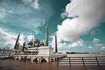 |

|
| 11-TRG/4 | Tengku Tengah Zaharah Mosque | Mosque | Kuala Ibai | 5°17′02″N 103°10′14″E / 5.283847°N 103.170685°E |  |

|
| 11-TRG/5 | Bangunan Persatuan Sejarah | Residential | Kuala Terengganu | 
| ||
| 11-TRG/6 | Bukit Keledang | Memorial Monument | Kuala Terengganu | 
| ||
| 11-TRG/7 | Abidin Mosque | Mosque | Kuala Terengganu | 5°20′04″N 103°08′16″E / 5.334445°N 103.137784°E | 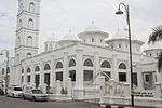 |

|
| 11-TRG/8 | Meriam Beranak | Memorial Monument | Kuala Terengganu | 
| ||
| 11-TRG/9 | Hiliran Mosque | Mosque | Kuala Terengganu | 5°18′53″N 103°07′28″E / 5.314703°N 103.124536°E |  |

|
| 11-TRG/10 | Tok Ku Mosque | Mosque | Kuala Terengganu | 
| ||
| 11-TRG/11 | Sultan Mahmud Airport | Airport | Kuala Nerus | 5°22′49″N 103°06′04″E / 5.380348°N 103.101129°E | 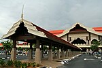 |

|
| 11-TRG/12 | Bukit Puteri | Memorial | Kuala Terengganu | 
| ||
| 11-TRG/13 | Losong Mosque | Mosque | Kuala Terengganu | 5°19′07″N 103°07′16″E / 5.318739°N 103.121211°E |  |

|
State of Negeri Sembilan
[edit]| SITE-ID | BUILDING NAME | BUILDING TYPE | LOCATION | COORDINATES | PHOTO | UPLOAD |
|---|---|---|---|---|---|---|
| 05-NSN/1 | King George V Secondary School | Educational Institution | Seremban | 2°43′07″N 101°56′41″E / 2.718721°N 101.944614°E |  |

|
| 05-NSN/2 | State Public Library | Government | Seremban |  |

| |
| 05-NSN/3 | Wesley Church | Church | Seremban | 2°43′24″N 101°56′12″E / 2.723452°N 101.936619°E |  |

|
| 05-NSN/4 | Seri Menanti Palace | Old Royal Residence | Kuala Pilah | 2°41′51″N 102°09′27″E / 2.697429°N 102.157471°E | 
| |
| 05-NSN/5 | Istana Ampang Tinggi | Old Royal Residence | Seremban |  |

| |
| 05-NSN/6 | Lister Memorial | Memorial Monument | Kuala Pilah | 
| ||
| 05-NSN/7 | Lukut Museum and Fort | Museum | Port Dickson | 2°34′12″N 101°49′22″E / 2.569946°N 101.822830°E |  |

|
| 05-NSN/8 | Gemencheh Bridge (Sungai Kelamah) Memorial | Memorial Monument | Gemencheh | 
| ||
| 05-NSN/9 | Wisma Negeri | Government | Seremban | 2°43′33″N 101°56′32″E / 2.725923°N 101.942288°E |  |

|
| 05-NSN/10 | Istana Besar Seri Menanti | Royal Residence | Kuala Pilah |  |

| |
| 05-NSN/11 | Kuala Pilah Mosque | Mosque | Kuala Pilah |  |

| |
| 05-NSN/12 | Cape Rachado Lighthouse | Monument | Port Dickson | 2°24′26″N 101°51′07″E / 2.407169°N 101.852010°E |  |

|
| 05-NSN/13 | Tuanku Munawir Royal Mosque | Mosque | Seri Menanti | 
| ||
| 05-NSN/14 | Seremban Jamek Mosque | Mosque | Seremban | 2°43′51″N 101°56′18″E / 2.730816°N 101.938284°E |  |

|
| 05-NSN/15 | St. Paul's Institution | Educational Institution | Seremban | 2°43′43″N 101°55′58″E / 2.728677°N 101.932811°E |  |

|
State of Sarawak
[edit]| SITE-ID | BUILDING NAME | BUILDING TYPE | LOCATION | COORDINATES | PHOTO | UPLOAD |
|---|---|---|---|---|---|---|
| 13-SWK/1 | Bishop’s House | Residential | Kuching | 1°33′22″N 110°20′47″E / 1.556156°N 110.346314°E |  |

|
| 13-SWK/2 | Fort Lily | Old Fort | Betong | 
| ||
| 13-SWK/3 | Fort Emma | Old Fort | Kanowit | 2°06′06″N 112°09′29″E / 2.101626°N 112.158062°E | 
| |
| 13-SWK/4 | Fort Alice | Old Fort | Sri Aman | 1°14′23″N 111°27′43″E / 1.239659°N 111.461839°E |  |

|
| 13-SWK/5 | Astana | Residential | Kuching | 1°33′49″N 110°20′44″E / 1.563591°N 110.345501°E |  |

|
| 13-SWK/6 | Old Court House | Government | Kuching | 1°33′34″N 110°20′41″E / 1.559482°N 110.344861°E | 
| |
| 13-SWK/7 | Fort Margherita | Old Fort | Kuching | 1°33′38″N 110°20′58″E / 1.560552°N 110.349428°E |  |

|
| 13-SWK/8 | Fort Sylvia | Old Fort | Kapit | 2°01′02″N 112°56′31″E / 2.017224°N 112.941925°E | 
| |
| 13-SWK/9 | Round Tower | Monument | Kuching |  |

| |
| 13-SWK/10 | St. Thomas Anglican Boy’s School | Educational Institution | Kuching | 
| ||
| 13-SWK/11 | Sarawak Museum | Museum | Kuching | 1°33′17″N 110°20′36″E / 1.554790°N 110.343357°E |  |

|
| 13-SWK/12 | St. Joseph Catholic Boy’s School | Educational Institution | Kuching |  |

| |
| 13-SWK/13 | Fort Hose | Old Fort | Marudi | 
| ||
| 13-SWK/14 | Education Department | Government | Kuching |  |

| |
| 13-SWK/15 | Pavilion Building | Kuching |  |

| ||
| 13-SWK/16 | The Council Negeri Memorial | Government | Bintulu | 3°10′23″N 113°02′20″E / 3.173°N 113.038856°E |  |

|
| 13-SWK/17 | Chinese History Museum | Museum | Kuching | 1°33′28″N 110°20′56″E / 1.557666°N 110.348755°E |  |

|
| 13-SWK/18 | Hoover Memorial Square | Memorial | Sibu | 2°19′40″N 111°50′11″E / 2.327762°N 111.836312°E |  |

|
| 13-SWK/19 | Limbang Museum | Museum | Limbang | 4°44′52″N 115°00′22″E / 4.747893°N 115.006167°E | 
| |
| 13-SWK/20 | Islamic Heritage Museum | Museum | Kuching | 
| ||
| 13-SWK/21 | Fort Hose | Old Fort | Marudi | 4°10′38″N 114°19′29″E / 4.177099°N 114.324739°E | 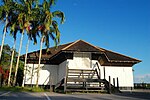 |

|
| 13-SWK/22 | San Ching Tian temple | Temple | Miri | 4°25′22″N 114°00′11″E / 4.422643°N 114.002990°E |  |

|
| 13-SWK/23 | Square Tower | Monument | Kuching | 1°33′37″N 110°20′44″E / 1.560250°N 110.345606°E |  |

|
| 13-SWK/24 | Sikh Temple | Temple | Kuching | 1°33′28″N 110°20′31″E / 1.557693°N 110.342004°E |  |

|
| 13-SWK/25 | Tua Pek Kong Temple | Temple | Kuching | 1°33′26″N 110°20′57″E / 1.557170°N 110.349037°E |  |

|
| 13-SWK/26 | Sarawak State Mosque | Mosque | Kuching |  |

| |
| 13-SWK/27 | Yu Lung San Tien En Si (Jade Dragon Temple) | Temple | Sibu | 2°17′20″N 112°01′06″E / 2.288978°N 112.018399°E |  |

|
| 13-SWK/28 | Tua Pek Kong Temple (Pre-1839) | Temple | Kuching |  |

| |
| 13-SWK/29 | Kuching Resident and District Office | Government | Kuching |  |

| |
| 13-SWK/30 | Chinese Chamber of Comerce | Government | Kuching | 
| ||
| 13-SWK/31 | Maderasah Melayu Building | Educational Institution | Kuching | 
| ||
| 13-SWK/32 | Central Police Station | Government | Kuching |  |

| |
| 13-SWK/33 | Post Office | Government | Kuching | 1°33′30″N 110°20′42″E / 1.558321°N 110.345066°E |  |

|
| 13-SWK/34 | Sarawak New Parliament Building | Government | Kuching | 1°33′43″N 110°20′53″E / 1.561881°N 110.347937°E | 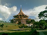 |

|
| 13-SWK/35 | Hong San Si Temple | Temple | Kuching | 1°33′27″N 110°20′53″E / 1.557436°N 110.347920°E |  |

|
| 13-SWK/36 | Charles Brooke Memorial | Memorial | Kuching |  |

| |
| 13-SWK/37 | Sarawak Steamship Company | Kuching | 
| |||
| 13-SWK/38 | Brooke Dockyard | Kuching | 1°33′35″N 110°20′29″E / 1.559614°N 110.341369°E |  |

|
State of Perlis
[edit]| SITE-ID | BUILDING NAME | BUILDING TYPE | LOCATION | COORDINATES | PHOTO | UPLOAD |
|---|---|---|---|---|---|---|
| 09-PLS/1 | Alwi Mosque | Mosque | Kangar | 6°26′27″N 100°11′52″E / 6.440866°N 100.197879°E |  |

|
| 09-PLS/2 | Al-Hussain Floating Mosque | Mosque | Kuala Perlis | 6°23′48″N 100°07′38″E / 6.396720°N 100.127154°E |  |

|
| 09-PLS/3 | Kota Kayang Museum | Museum | Kangar | 6°24′57″N 100°08′56″E / 6.415721°N 100.148754°E | 
| |
| 09-PLS/4 | Court House of Kangar | Government | Kangar | 
| ||
| 09-PLS/5 | Tuanku Syed Putra Jamalullail Mosque | Mosque | Kangar | 6°27′11″N 100°12′26″E / 6.453104°N 100.207159°E |  |

|
| 09-PLS/6 | Dato Wan Ahmad House | Residential | Kangar | 
|
State of Kedah
[edit]| SITE-ID | BUILDING NAME | BUILDING TYPE | LOCATION | COORDINATES | PHOTO | UPLOAD |
|---|---|---|---|---|---|---|
| 02-KDH/1 | Art Center Building | Museum | Alor Setar | 6°07′08″N 100°21′56″E / 6.118803°N 100.365588°E |  |

|
| 02-KDH/2 | Balai Nobat | Monument | Alor Setar | 6°07′16″N 100°22′00″E / 6.120991°N 100.366607°E |  |

|
| 02-KDH/3 | Big Clock Building | Monument | Alor Setar | 
| ||
| 02-KDH/4 | High Court Building | Government | Alor Setar | 6°08′54″N 100°21′50″E / 6.148322°N 100.364007°E |  |

|
| 02-KDH/5 | Kuning Palace | Palace | Alor Setar | 6°07′24″N 100°22′07″E / 6.123429°N 100.368482°E |  |

|
| 02-KDH/6 | Police Station | Government | Alor Setar | 6°07′49″N 100°22′21″E / 6.130325°N 100.372625°E | 
| |
| 02-KDH/7 | Sepachendera Palace | Palace | Alor Setar |  |

| |
| 02-KDH/8 | Wat Nikrodharam | Temple | Alor Setar | 6°07′31″N 100°22′18″E / 6.125366°N 100.371652°E | 
| |
| 02-KDH/9 | Zahir Mosque | Mosque | Alor Setar | 6°07′13″N 100°21′54″E / 6.120348°N 100.365120°E |  |

|
| 02-KDH/10 | Alor Setar Tower | Monument | Alor Setar | 6°07′28″N 100°22′04″E / 6.124415°N 100.367673°E |  |

|
| 02-KDH/11 | Kota Mahsuri | Monument | Langkawi | 
| ||
| 02-KDH/12 | Eagle Square | Monument | Langkawi | 6°18′30″N 99°51′07″E / 6.308460°N 99.851880°E |  |

|
| 02-KDH/13 | Bujang Valley | Museum | Merbok | 5°44′16″N 100°24′52″E / 5.737854°N 100.414480°E |  |

|
| 02-KDH/14 | Istana Anak Bukit | Residential | Kuala Kedah | 6°10′28″N 100°21′55″E / 6.174426°N 100.365272°E | 
| |
| 02-KDH/15 | Syariah Court | Government | Alor Setar | 6°11′05″N 100°22′32″E / 6.184713°N 100.375529°E |  |

|
State of Pahang
[edit]| SITE-ID | BUILDING NAME | BUILDING TYPE | LOCATION | COORDINATES | PHOTO | UPLOAD |
|---|---|---|---|---|---|---|
| 06-PHG/1 | Clifford School | Educational Institution | Kuala Lipis | 
| ||
| 06-PHG/2 | District Offices | Government | Kuala Lipis | 
| ||
| 06-PHG/3 | Kuala Lipis Club | Kuala Lipis | 
| |||
| 06-PHG/4 | Sultan Ahmad Shah State Mosque | Mosque | Kuantan | 3°48′29″N 103°19′41″E / 3.807959°N 103.327939°E |  |

|
| 06-PHG/5 | Istana Hinggap | Palace | Kuala Lipis | 4°11′07″N 102°03′09″E / 4.185184°N 102.052376°E | 
| |
| 06-PHG/6 | Residence of the District Officer | Government | Kuala Lipis | 
| ||
| 06-PHG/7 | The Residency Building | Government | Kuala Lipis | 
| ||
| 06-PHG/8 | Malay Hostel | Kuala Lipis | 
| |||
| 06-PHG/9 | Kuala Lipis Railway Station | Public | Kuala Lipis | 4°11′14″N 102°03′11″E / 4.187252°N 102.053122°E |  |

|
| 06-PHG/10 | State Secretary's House | Goverment | Kuala Lipis | 
| ||
| 06-PHG/11 | State's Mosque | Mosque | Kuala Lipis | 
|
| Wiki Loves Monuments 2016 | |||
|---|---|---|---|
|
Tools - FAQ - Media - Who's who - List of landing page, monuments and uploadlink - Winning photos For local organisers - Landing pages - CentralNotice - Upload campaigns - Winners (tracking page) - Lists of monuments - Overview of monuments Lists of monuments in: Africa - Asia - Europe - North America - Oceania & Antarctica - South America
|

| ||


